West Carson City

West Side
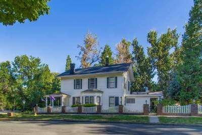
Known for the foothills, mature landscaping, quiet and friendly neighborhoods, West Side is perfect for wanderers.
The area consists of a variety of communities, including Kings Canyon, Ash Canyon, Highlands, Historic District, Wellington and Carriage Square.
Although it’s surrounded by breathtaking desert trails, downtown is only about a 2- mile walk.
That’s why the West Side is perfect for those who want everything Carson City offers.
Area special events
Brewery Arts Center – From plays to live musicals, to galleries and guest speakers, the Brewery Arts Center is a non-profit organization that hosts a variety of art and entertainment events – including Zumba every Wednesday.
Ghost Walk – Stories and tours of Carson City’s most haunted places occur every October. The program also offers tours designed for children.
Nearby schools
Public Schools – Bordewich Bray Elementary, Fristch Elementary, and Carson Middle School.
Private Schools – St. Teresa’s of Avila School, Bethlehem Lutheran.
Nearby parks
Carriage Square, Long Ranch, Monte Vista Park, Sunset.
Places to explore
Ash to Kings Trail – This newly constructed seven-mile trail offers great views of the valley. It links to Ash Canyon Road on the north end and Kings Canyon Road on the south end.
Kings Canyon Waterfall – This stunning, accessible trail is the perfect getaway in Carson City. The loop is 1.8 miles leading to the Kings Canyon Falls cascades 25 feet along the creek. Many hikers enjoy swimming in the falls during the summertime.
V&T Trail – Located between Kings Canyon Road and Combs Canyon Road, this is an ideal trail for runners. The 1.9-mile trail is gradually graded and it wraps around the north side of Carson City with great views. Although many runners enjoy this route, it’s guaranteed hikers will love it, too.
Lone Mountain Trail – North of Lone Mountain Cemetery, there’s a natural area with walking trails and more scenic views of Carson City. The trailhead is paved for parking.
C-Hill – The “C” on top of a hill, representing Carson City, can be seen downtown.
But if you’re curious to see what downtown looks like from the hill, there’s an opportunity for that.
Hikers can find trailheads off Curry Street just south of downtown or off King Street. Although it’s an elevated trail, the results are worth it – you also get a stunning view of the desert peaks of the east and the Sierra Nevada mountains.
Blue Line Trail – If hiking up hills isn’t your finesse, the Kit Carson Trail is located at the heart of town. It features stops at some of Nevada’s noted historical landmarks—at least 60 of them—including Victorian-style homes, museums, and churches.
Maps can be obtained at the Carson City Parks and Rec website, the Carson City Vistors Bureau or through the VisitCarsonCity app.